blog
Home

Blog

Blog

  • How to use drones safely in winter-winter drone flying tips
    How to use drones safely in winter-winter drone flying tips
    Dec 05, 2025
                How to operate the drone stably in winter or cold weather? And what are the tips for operating a Drone in winter?       First of all, the following four problems generally occur in winter flying:   1) Reduced battery activity and shorter flight time;   2) Reduced control feel for flyers;   3) Flight control electronics work abnormally;   4) The plastic parts included in the frame become brittle and less strong.         The following will be explained in detail:   1. Reduced battery activity and shorter flight time   -Low temperature will make the battery discharge performance greatly reduced, then the alarm voltage needs to be increased, the alarm sound needs to be landed immediately. -The battery needs to do insulation treatment to ensure that the battery is in a warm environment before takeoff, and the battery needs to be installed quickly during takeoff.   -Low temperature flight try to shorten the operating time to half of the normal temperature state to ensure safe flight.   Frequently Asked Questions:   1) Battery use temperature? The recommended operating temperature is above 20°C and below 40°C. In extreme cases, it is necessary to ensure that the battery is used above 5°C, otherwise the battery life will be affected and there is a great safety risk.   2) How to keep warm? -In a heated room, the battery temperature can reach room temperature (5°C-20°C) -Without heating, wait for the battery temperature to rise above 5 degrees (to prevent do not operate, do not install propellers indoors) -Turn on the air conditioning in the car to raise the battery temperature to more than 5 ° C, 20 ° C best.   3) Other matters needing attention? -The battery temperature must be above 5°C before the motor is unlocked, 20°C is best. The battery temperature reaches the standard, need to fly immediately, can not be idle. -The biggest safety risk of winter flying is the flyer himself. Risky flight, low battery flight are very dangerous. Make sure the battery is fully charged before each takeoff.   4) Will the flight time be shorter in winter than other seasons? About 40% of the time will be shortened. Therefore, it is recommended to return to landing when the battery level is 60%. The more power you have left, the safer it is.   5) How to store the battery in winter? Insulated, dry storage space.   6) Is there any precautions for charging in winter? Winter charging environment at about 20°C best. Do not charge the battery in a low temperature environment.   2. Reduced control feel for flyers Use special gloves to reduce the impact of low temperature on finger dexterity.   3. Flight control electronics work abnormally Flight control is the control core of the drone, the drone needs to be preheated before taking off in low temperature, the way you can refer to the battery preheating method.   4. The plastic parts included in the frame become brittle and less strong Plastic parts will become weak because of low temperature, and can not do big maneuvering flight in low temperature environment flight.     Landing must be kept smooth to reduce the impact.       Summary:   -Before takeoff: preheat to above 5°C, 20°C is best.   -In flight: Do not use large attitude maneuvers, control the flight time, ensure that the battery power is 100% before takeoff and 50% for landing.   -After landing: dehumidify and maintain the drone, store it in a dry and insulated environment, and do not charge it in a low-temperature environment.
  • How to choose the right agricultural drone
    How to choose the right agricultural drone
    Dec 08, 2025
                  As agriculture becomes more and more integrated with technology, agricultural drones have become an indispensable tool for farm operations. The use of drones in farms has greatly improved the efficiency of farm operations, reduced costs, and increased profits for farmers.   Agricultural Drones are Mainly Used for The Following Purposes:   Crop Monitoring: Farmers can assess plant health and growth through high-resolution images. Precision Seeding: Precise application of fertilizers and pesticides helps reduce waste and reduce costs. Soil Analysis: Drones can quickly and efficiently assess soil moisture and nutrient distribution. Irrigation Management: Monitoring the effectiveness of irrigation systems helps optimize water use. Livestock Monitoring: Drones can easily track livestock locations and observe their health. Pest and Disease Detection: Early identification of pests and diseases facilitates timely treatment.                 There are many agricultural drone models on the market, and considering the Following Aspects can help you make an informed decision.   1. Evaluate the Carrying Capacity First, consider the carrying capacity of the drone, which determines the equipment or sensors it can carry. If you plan to use it for spraying pesticides or fertilizers, choose a model with a higher payload capacity. For imaging and monitoring tasks, choose a drone that is compatible with multispectral or thermal imaging cameras.   2. Evaluate Flight Time and Range Flight time is critical for efficiently covering large areas. Agricultural drones typically have a flight time of between 20 and 30 minutes, depending on the model and payload. Make sure the operating range can cover your entire farm to avoid frequent charging or returning to base.   3. Focus on Camera Quality and Sensors Effective crop monitoring relies on the quality of cameras and sensors: Multispectral Camera: Captures different wavelengths of light to assess plant health. High-resolution Camera: Provides detailed images to help identify problems at an early stage. Thermal Imaging Sensor: Detects temperature changes in crops and soil, providing valuable data reports.   4. Prioritize Ease of Use Ease of use is critical to reduce operator requirements, labor costs and time costs: Autonomous Flight: The drone can be programmed to follow a specific flight path for easy operation. Real-time Data Processing: Provides instant analysis and reporting capabilities to deliver results quickly. Mobile APP Compatibility: Access controls and data through smartphone apps to simplify operations.   5. Ensure Compliance Be familiar with local regulations regarding the use of agricultural drones. In many areas, pilots must be licensed or follow specific commercial operating guidelines. Choose a drone that complies with these regulations to avoid any problems.   6. Consider Budget Constraints The price of agricultural drones varies depending on the features. It depends on your budget.   7. Manufacturer Reputation and Service Research the manufacturer to assess its reliability and customer service quality. Reputable manufacturers will provide strong support, warranty options, and regular software updates to ensure that your drone runs smoothly.               In short, choosing the right agricultural drone can greatly improve the efficiency of farm operations. By considering the above aspects, I believe you can find an agricultural drone that fits your new needs. I wish you a happy flight!
  • What are the industry applications for drones?
    What are the industry applications for drones?
    Dec 11, 2025
    Drones (UAVs) are remote-controlled or autonomous devices with applications spanning multiple industries. Originally military tools, they now drive innovation in agriculture, logistics, media, and more.   Agriculture and Environmental Conservation In agriculture, Agriculture drones monitor crop health, spray pesticides, and map farmland. They collect data to optimize irrigation and predict yields. For environmental protection, drones track wildlife, monitor deforestation, and assess disaster-stricken areas like wildfires or floods.     Cleaning and Maintenance Innovation Cleaning drones equipped with high-pressure spray systems perform precise cleaning tasks in high-risk environments. In the field of high-altitude building maintenance, they replace traditional gondolas or scaffolding systems to clean glass curtain walls and skyscraper facades, achieving over 40% efficiency improvements compared to conventional methods. For energy infrastructure maintenance, drones remove dust accumulation on photovoltaic power stations, ensuring optimal power generation efficiency.     Other Key Industry Applications Logistics & Infrastructure: Drones deliver packages and emergency supplies; inspect infrastructure. Media & Safety: Capture aerial footage for films/sports; aid rescue missions and crime scene analysis.
  • What Should Be Considered in Plant Protection Drone Spraying Operations?
    What Should Be Considered in Plant Protection Drone Spraying Operations?
    Dec 16, 2025
    With technological advancements, plant protection drones are playing an increasingly important role in agricultural operations. They not only improve work efficiency but also significantly reduce the labor intensity for farmers. However, what should pilots pay attention to when conducting plant protection drone spraying operations?   1. Pre-Operation Preparations     - Conduct thorough inspections before Spray Agricultural Drones flight to ensure safe operations.   1 ) Drone Inspection: Before each flight, conduct a comprehensive check of the drone to ensure the fuselage, wings, sensors, cameras, and other equipment are intact.   2 ) Pesticide Dilution: Follow the pesticide instructions to ensure proper dilution ratios, avoiding concentrations that are too high or too low, which could affect effectiveness.   3 ) Weather Conditions: Monitor weather changes before flight and avoid operations in harsh conditions such as strong winds, heavy rain, or thunderstorms.   2. In-Flight Precautions     - Avoid low-battery takeoffs to prevent crashes or battery over-discharge.   1 ) Flight Altitude and Speed: Adjust altitude and speed based on crop type and growth stage to ensure even pesticide coverage.   2 ) Battery Capacity: The drone’s battery endurance is critical for operational efficiency. Use high-quality batteries with high energy density and long endurance to maximize flight time.   3 ) Flight Safety: Operators must remain highly focused during flight and be prepared to handle emergencies.   3. Post-Operation Maintenance   - Clean the drone and batteries promptly after operations to remove pesticide residue.   1 ) Drone Cleaning: Clean the drone immediately after use to prevent corrosion from pesticide residue.   2 ) Battery Charging and Storage: Recharge batteries promptly after use and store them in a cool, dry place. High-efficiency charging technology from energy storage stations enables rapid charging for drone batteries while supporting simultaneous charging of multiple batteries, significantly improving efficiency. Additionally, energy storage stations feature intelligent power management, automatically adjusting charging current based on battery status to prolong battery health.
  • Unattended Systems Empower Natural Resource Management
    Unattended Systems Empower Natural Resource Management
    Dec 17, 2025
    Natural resources are an important material basis for the development process of human society and are vital for maintaining ecological balance and realizing sustainable development. However, as natural resources are vast and widely distributed, traditional survey methods are often inefficient and costly. Through the unattended system, provides efficient and accurate solutions for natural resources management.     Mineral Resources Management Intelligent Inspection, Guarding the Safety of Mineral Resources                         
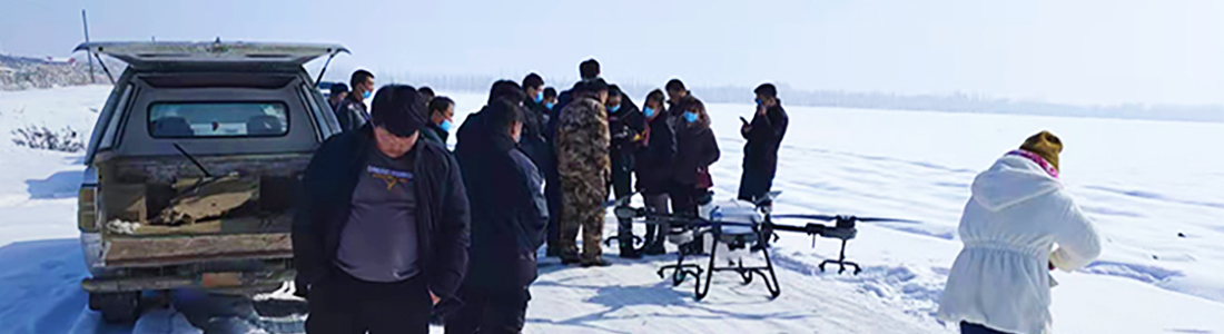
The development and utilization of mineral resources requires strict supervision to prevent illegal mining and resource wastage. The Mineral Deposit Illegal Mining Detection combines the laser radar (LiDAR) and high-precision optical camera, tilt camera, dual-optical pods and other payloads carried by the drone to carry out all-around inspections of the mining area around the clock, monitor mining activities in real time, and detect illegal behaviors in a timely manner.   At the same time, the drone can also monitor the ecological environment of the mining area and assess the effect of mine restoration. The automated inspection function of the unmanned system reduces labor costs and improves the efficiency and safety of mine supervision.       Forest and Grassland Resources Management Science and Technology Helping to Guard the Green Ecological Barrier   Forests and grasslands are the “lungs” of the Earth, and their protection and management are of paramount importance. The unattended system combines ortho cameras, LIDAR, spectral cameras, video pods, etc., carried by UAVs, to monitor the growth status of forest and grassland resources, pests and diseases in real time.     Especially in forest fire prevention and emergency response, the UAV can quickly locate the fire source, assess the fire spreading trend, and provide scientific basis for fire-fighting command. The automated monitoring function of the unmanned system realizes all-weather supervision of forest and grass resources and provides strong technical support for ecological protection.     Wetland and Nature Reserve Management Technology Guards, Ecological Treasures   Wetlands and nature reserves are important carriers of biodiversity. The unmanned system, combined with the high-resolution optical camera and thermal imager carried by the drone, can quickly obtain image data of wetlands and nature reserves, monitor ecological changes and assess the effectiveness of protection. The automated inspection function reduces the disturbance to the nature reserves while improving the efficiency and precision of monitoring, providing a scientific basis for the management to formulate protection strategies.     Water Resources Management Technology Empowered to Guard the Source of Life   The rational utilization and protection of water resources is an important part of natural resource management. The unattended system, combined with the multispectral sensors and water quality monitoring equipment carried by drones, can inspect rivers, lakes and other waters, monitor changes in water quality, and assess the development and utilization of water resources. It realizes all-weather supervision of water resources and provides data support for water resources management.     Marine Resource Management Science and Technology Helping to Guard the Blue Land                         The unattended system combines high-resolution optical cameras and marine monitoring equipment carried by drones to patrol coastlines and sea areas, monitor the exploitation and utilization of marine resources and assess the marine ecological environment. The automated inspection function reduces interference with the marine environment while improving the efficiency and precision of monitoring, providing support for marine resource management.     Cropland Red Line Management Technology Guards, Food Security Bottom Line   Arable land is the foundation of food production, and protecting arable land is protecting food security. The unmanned guarding system combines the high-resolution optical camera and multi-spectral sensor carried by the drone to carry out regular inspections of arable land, and timely discover and record the illegal occupation and destruction of arable land. It realizes all-weather supervision of arable land resources and provides data support for arable land protection.     Natural Resources Movement Monitoring and Oversight Technology Empowered, Accurately Grasp Resource Dynamics   Natural resource survey and monitoring is the foundation of natural resource management. The unmanned system, combined with the LiDAR and high-resolution optical camera carried by the drone, can quickly obtain high-resolution images and generate natural resource distribution maps, providing a scientific basis for the management department.   At the same time, combined with the high-resolution optical camera and thermal imager carried by the unmanned aircraft, it inspects natural resources development and utilization activities, discovers and records violations of law in a timely manner, realizes all-weather supervision of natural resources development and utilization activities, and provides conclusive evidence for law enforcement departments.     Ecological Restoration and Environmental Protection Science and Technology Helping to Restore Green Water and Mountains   Ecological restoration is an important task in natural resource management. The unmanned system combines the multi-spectral sensor and high-resolution optical camera carried by the drone to monitor the ecological restoration area and assess the restoration effect. The automated monitoring function realizes all-weather supervision of ecological restoration areas and provides data support for ecological restoration projects.  
  • Satellite-based Navigation System Could Free Drones from GPS
    Dec 22, 2025
                           Australian researchers have developed a groundbreaking astronomical navigation system for unmanned aircraft that eliminates the reliance on GPS signals, potentially transforming the operation of military and commercial drones, citing foreign media sources. The breakthrough comes from the University of South Australia, where scientists have created a lightweight, cost-effective solution that enables unmanned aerial vehicles (UAVs) to use star charts to determine their location.                            The system represents a significant advancement in Beyond Visual Line of Sight (BVLOS) capabilities, especially in environments where GPS signals may be compromised or unavailable. When tested with a fixed-wing UAV, the system achieved positional accuracy within 2.5 miles-an encouraging result for an early technology.                          What sets this development apart is its pragmatic approach to a long-standing challenge. While astronomical navigation has been used for decades in aviation and maritime operations, traditional star tracking systems are too bulky and expensive for small UAVs. The University of South Australia team, led by Samuel Teague, eliminated the need for complex stabilization hardware while maintaining functionality.                          The impact of drone safety cuts both ways. For legitimate operators, the technology can withstand GPS jamming - a growing problem highlighted by the ongoing conflict over electronic warfare disrupting legacy navigation systems. However, operating drones with undetectable GPS radiation may also make them more difficult to track and intercept, which could complicate counter-drone operations.                          From a commercial perspective, the system could enable more reliable remote inspection missions and environmental monitoring in remote areas where GPS coverage is unreliable. The researchers emphasize the accessibility of the technology and note that off-the-shelf components can be used to implement it.                          This progress comes at a critical time in the development of drones. Recent incidents of unauthorized drone overflights of sensitive facilities highlight the need for enhanced navigation capabilities and improved detection methods. As the industry moves toward smaller, more expendable platforms, innovations such as this star-based system may accelerate the trend toward autonomous operations in GPS-constrained environments.                          The findings of the UDHR have been published in the journal UAV, marking an important step towards a more resilient and independent UAV navigation system. As development continues, the balance between operational capabilities and security considerations may affect the implementation of the technology in both military and civilian applications.
1 2 3 4 5

leave a message

leave a message
If you are interested in our products and want to know more details,please leave a message here,we will reply you as soon as we can.
submit

Our hours

Mon 11/21 - Wed 11/23: 9 AM - 8 PM
Thu 11/24: closed - Happy Thanksgiving!
Fri 11/25: 8 AM - 10 PM
Sat 11/26 - Sun 11/27: 10 AM - 9 PM
(all hours are Eastern Time)

Contact Us: q157050@gmail.com

home

products

WhatsApp

Contact Us