blog
Home

Blog

Blog

  • Coastal erosion analysis and monitoring using drones
    Coastal erosion analysis and monitoring using drones
    Oct 27, 2025
                The popularity and affordability of Unmanned Aerial Vehicles (UAVs) has benefited many industries by reducing costs and increasing personnel safety. But what about the scientific community? Hundreds, if not thousands, of independent scientists and universities around the world use these UAVs to conduct complex scientific experiments in new ways.               We tend to focus on the industrial and commercial applications of UAVs, but pure science also benefits from the affordability and availability of aviation when budgets are tight and time to complete experiments is critical.               For example, several Polish scientists collaborated on a comprehensive study of coastal erosion, using several new technologies such as airborne LiDAR and bathymetry.               Pawel Tysiac and Rafal Ossowski of the Faculty of Civil and Environmental Engineering at the Gdansk University of Technology, in collaboration with Lukasz Janowski of the Maritime Academy of the Maritime University of Gdynia and Damian Moskalewicz of the Department of Geomorphology and Quaternary Geology at the Faculty of Oceanography and Geography of the University of Gdansk, have culminated in a comprehensive study of the erosion of a portion of the Polish coast (more More specifically, a 1-mile stretch of the southern Baltic Sea).               The paper is entitled "Assessment of coastal cliff degradation using drone and orthophoto data and bathymetric LiDAR in Google Earth Engine". It was published in Scientific Reports, January 2025 and is a prime example of the use of new technologies to collect data that is critical to understanding the ways in which nature changes geography.               We had the opportunity to speak with Pawel Tysiac, one of the study's authors, to better understand the impact of drones and LiDAR on their project.               "Traditional methods of monitoring cliff erosion typically require labor-intensive field work and complex calculations of spatial point distributions using traditional land surveying techniques," said Pawel. "In contrast, recent advances in remote sensing and machine learning offer new methods for assessing cliff degradation with greater efficiency and accuracy."               Coastal degradation has attracted the attention of governments and scientists around the world as the number of natural disasters increases and each disaster causes more and more damage to populations and geographic environments.                       "In this paper, we use the term 'bluff degradation' broadly. We define it as the overall ultimate impact of changes in erosive coastal cliffs caused by a variety of factors and processes, including complex lithologic and hydrogeologic environments, storm surge wave activity, rainfall, wind blowing, and human activities that lead to the development of large-scale movements and their impacts, such as landslides, faults, fissures, and debris," Pawel said. "Based on this, a key premise of this study is that the electromagnetic wave reflectance spectrum varies in areas affected by degradation. In the case of coastal bluffs, changes in material aggregation, vegetation and other factors can lead to significant differences."               Today, remote sensing is the standard method for monitoring coastal environments. By utilizing various types of images and data collected from satellites, airborne platforms, and ground-based sensors, researchers can obtain detailed and up-to-date spatial information about coastal areas. Timely resolution frame images allow observation of changes in coastal morphology over time and help to identify areas most affected by natural disasters. In this case, the authors used aerial photography, which provides high-resolution images useful for detailed before-and-after comparisons. However, there is the problem of different times of illumination on the images, leading to different objects to be processed. In terms of photogrammetry, flights need to be conducted under similar conditions, but there are still some issues with seasonal variations in this regard.                 "We decided to use LiDAR as an alternative to deal with changing lighting conditions," says Pawel. "LiDAR data is essential for measuring coastal topographic changes with high accuracy, helping to filter data from vegetation or isolated points. The most important product of LiDAR is the Digital Elevation Model (DEM), which is used to create a 3D representation of the coastal landscape. These models help to understand the spatial distribution of erosion by calculating models over time."                           The problem arose because the component of coastal degradation that occurs underwater plays a significant role in causing this phenomenon to occur, hence the decision to use LiDAR as a bathymetric tool.               Pawel said, "The results of the study give us insight into how coastal cliffs are responding to current and future climate change, particularly sea level rise and increased storm activity." "Enhancing traditional geotechnical surveys by utilizing proposed advanced remote sensing technologies, such as the use of Mapping drone and airborne surveys, provides a model for other areas facing similar challenges. The insights gained from this study can inform coastal management policies not only in Poland, but also in other regions with similar geological and environmental conditions. Effective management plans based on such research can help mitigate the risks to human life and infrastructure posed by coastal cliff erosion and instability."                 By combining aerial and maritime information collection from autonomous vehicles, this group of scientists was able to improve the quality of the data, the precision of the conclusions, and the adequacy of the actions taken to mitigate the damage to the geography and inhabitants of the affected areas.
  • L.A. fires highlight promise of drone firefighting
    L.A. fires highlight promise of drone firefighting
    Oct 30, 2025
                Technology companies in Los Angeles and Silicon Valley are volunteering their services, including deploying drones equipped with artificial intelligence (AI) capabilities "to detect outbreaks and get to new fire scenes as quickly as possible," according to NBC Bay Area. The news outlet says these drones "can get closer to the flames than humans and can work with satellites to help map fires."               Many see the use of these technologies as a "rule changer" in the field of firefighting. According to recent reports, climate change, land management practices, and simple human behavior have led to an increase in wildfires in recent years, and emergency responders are turning to new systems to deal with the growing danger. In particular, artificial intelligence is being used to accelerate the processing and organization of large amounts of fire-related information. This information can help firefighters better deploy resources, make decisions and prevent fires from spreading.     California's Commitment to Drone Technology               Los Angeles' current efforts to use unmanned systems, artificial intelligence, and related technologies build on California's longstanding commitment to using drones to fight fires. In a Jan. 13 statement on wildfire response and forest management, California asserted that "Cal Fire has doubled its use of drones for critical tasks such as aerial ignition during prescribed burns, wildfire control and real-time assessments."               The statement added that California has also deployed Artificial Intelligence (AI) LiDAR and 3D maps to provide real-time intelligence to help firefighters "better understand and respond to complex terrain" and improve the way it delivers "evacuation orders, local shelter information, road closures, etc." in the way they communicate. In many cases, these technologies work in tandem with drones to accomplish this critical work.               The current crisis in Los Angeles isn't the first time drones have been used in California to help fight fires. For example, drones played a key role in the Dixie Fire in 2021. According to Inside Unmanned Systems, the drones were equipped with "potassium permanganate pellets that burst into flames when punctured and injected with ethylene glycol." The pellets, called "dragon eggs," help firefighters perform "aerial ignition," a process derived from "backfiring," in which "a fire ignites a patch of flames in a place where the fire has not yet spread," according to Inside Unmanned Systems. where the fire has not yet spread to cut off fuels."               In addition, during the Dixie Fire, some Emergency Rescue Aerial Drone were equipped with infrared equipment. This helped firefighters "find hot spots under the grass and provide a safe overhead view."               Drones also assisted with important research during and after California's devastating 2017 and 2018 hill fires. According to Commercial Drone News, "Drones were used in multiple communities to provide aerial damage assessment, mapping, documentation of impacted areas, and to improve situational awareness for emergency response teams in real time."   The Problem of Unauthorized Drones               There are many more examples of drones helping firefighters do important work in California and around the world, but some thorny issues with unmanned vehicles came to the fore during the recent crisis in Los Angeles. These problems were not caused by the officially authorized use of unmanned technology. They were caused by reckless, ignorant and unauthorized drone operators.               As of Wednesday, Jan. 15, three people have been arrested for unauthorized drone flights that hindered emergency response efforts in the Los Angeles area, according to UAS Vision. In one of the incidents, a private drone crashed into a firefighting aircraft known as a Super Scooper, rendering it unable to perform its critical mission.               The UAS Vision report explains, "Temporary flight restrictions were implemented over the wildfire area and federal authorities have deployed ground teams to intercept pilots violating FAA restrictions." In total, local authorities have spotted 48 private drones flying over the wildfire zone.   Drones Benefit the Public                 At a time when the many benefits of unmanned systems for firefighting applications are on full display, the careless and non-compliant behavior of these private drone operators has raised serious concerns about the widespread use of unmanned vehicles. These behaviors distract from the positive reports of drone flights benefiting the public.               As contributing writer Carla Lauter recently explained in Commercial Drone News, "While it's easy for those unfamiliar with drone work to imagine the negative possibilities, the truth about drones-especially in commercial and non-military applications-is more beneficial than many people realize." In the U.S. and around the world, the diverse, innovative and well-regulated drone industry is providing countless societal benefits in areas such as public safety, law enforcement and emergency response, she said.               Hopefully, private drone operators will learn important lessons from these incidents in Los Angeles, and that public agencies and regulators will find new ways to curb unauthorized drone activity, keep the public safe, and further promote the use of unmanned systems in emergency operations.
  • Quantum sensing technology and its impact on the manufacturing industry
    Quantum sensing technology and its impact on the manufacturing industry
    Nov 11, 2025
                In this article, we will discuss the types of quantum sensing technologies, their impact on manufacturing, and where the field is headed. Believe it or not, quantum sensing is a field of technology that has been around for more than 50 years and is now widely used in lasers such as LIDAR, magnetic resonance imaging (MRI), and photovoltaic cells.               Although society is already enjoying the benefits of these technologies, they are not as well known as the widely discussed quantum computing and quantum communications. The oft-cited "quantum advantage" refers to the ability of quantum computers to solve problems in very short periods of time, making previously impractical and complex problems feasible. Quantum communications are often discussed in the context of cybersecurity. Both areas are growing rapidly, but are still several years away from becoming ubiquitous.               The main approaches to quantum sensing are photonics and solid-state systems. Photonics deals with the manipulation of light in a variety of ways, while solid-state systems deal with sensors that are in a known quantum state that changes as a result of interaction with a stimulus (what you want to measure). Within these approaches, quantum sensing technologies fall into five different categories and have complementary strengths.                         (1) Quantum Imaging - the use of quantum lidar/radar to detect moving or hidden objects, with the best known application area being national defense.                         (2) Quantum Electromagnetic Sensors - These sensors measure dynamic electromagnetic fields using nitrogen vacancy centers, atomic vapors, and superconducting circuits. They are also used in defense applications, but are also used in healthcare, such as MRIs.               (3) Gravimeters & Gradiometers - They measure the strength and variation of the gravity field, respectively. Current applications include geophysical phenomena in the subsurface and are mainly used in the energy sector to find reservoirs.               (4) Thermometers & Barometers (Measuring Temperature & Atmospheric Pressure, Respectively) - these specialized tools are much more sensitive than those normally used, and achieve higher accuracy in critical applications such as submarines or aircraft through the use of cold atom clouds and superconducting quantum interface devices.               (5) Specific Sensing Applications With Quantum Computing or Communications or A Combination of Both - these applications need to be further developed as quantum computing and communications technologies mature.               Initially, quantum sensing technology was used in products we commonly see today, such as digital cameras. The next generation of quantum sensing technology that becomes commercially available will benefit manufacturers in a number of ways: by providing extremely high sensitivity in measurements where precision and accuracy are required, and by the regular emergence of new use cases in the aerospace, biomedical, chemical, automotive, and telecommunications industries. This is possible because these sensors utilize the quantum properties of systems to measure small physical changes and features in those systems.               The next generation of quantum sensing technology is designed to be smaller, lighter, and more cost-effective than its predecessor, and offers incredibly high measurement resolution compared to traditional sensing technologies. Early use cases include quality control measurements on high-quality products by identifying tiny defects, rigorous measurements on precision products, and non-destructive testing by measuring what's hidden under the surface.               Current barriers to the adoption of next-generation quantum sensing technologies include development costs and time, which could delay adoption across the industry. Other challenges include integration of new sensors with existing data frameworks and standardization within the industry - issues that mirror many of the challenges of adopting and assimilating emerging technologies. Industries that are less price-sensitive and will benefit the most will take the lead. Once the defense, biotech, and automotive industries have demonstrated applications and business cases for these sensitive technologies, additional use cases will emerge as the technology evolves and scales. Methods and techniques for measuring at higher resolutions will become even more important as the manufacturing industry adopts new technologies to improve accuracy and flexibility without sacrificing quality or productivity.               It is important to focus on the benefits that can be realized by combining other leading technologies with quantum sensing, such as wireless networks. Manufacturing-related industries, such as construction and mining, will also benefit. If technology can develop these sensors to be small and cheap enough, they could potentially make their way into your smartphone as well.
  • Drone recognition algorithms provide deep insight into urban problems
    Drone recognition algorithms provide deep insight into urban problems
    Nov 12, 2025
                Combining AI recognition algorithms with drones, it provides automatic identification and alarms for problems such as street-occupying business, domestic garbage piling up, construction garbage piling up, and unauthorized construction of color steel tiles facilities in the city, and better integrates urban low-altitude data for urban management problems, significantly improving the effectiveness of urban perception and service supervision.   Recognition of Road Occupation                         Intelligent drones automatically identify the occupying business on both sides of urban roads, and when illegal occupying behaviors are identified, they will be automatically recorded and an alarm will be issued, prompting management personnel to deal with them in a timely manner. Compared with traditional drone inspection methods, the algorithm significantly improves monitoring efficiency and accuracy, reduces the inspection workload of urban management personnel, and safeguards the smoothness and cleanliness of urban roads.         Domestic Garbage Pile Identification               Intelligent Recognition Drones quickly locate garbage piles through image recognition, providing precise location information and generating reports to help managers deal with them in a timely manner. It improves efficiency and has a wider coverage, reduces environmental pollution and improves urban environmental health.           Construction Waste Pile Identification               Drones can monitor construction waste piles in real time, by automatically recognizing illegal piles and generating alerts. With the application of drone AI recognition algorithms, the supervision of construction waste becomes more efficient and accurate, which helps to maintain the cleanliness of the urban environment and construction safety.         Color Steel Tile Identification               Through aerial images taken by drones, illegal color steel tile facilities are automatically identified, assisting city managers to detect and deal with violations in a timely manner. The algorithm improves identification efficiency and accuracy, reduces blind spots and omissions in manual inspections, and safeguards urban planning and safety.                     "Low Altitude + AI" for urban planning, urban construction, urban management, water, environmental protection, transportation and other fields, FUYA intelligent city management series drone AI recognition algorithms also support multiple algorithms running at the same time, to improve the effect of data processing, to serve the city management of a number of departments, for the construction of a smart city to provide a solid technical guarantee.
  • Drone Assistant Mountain Rescue
    Nov 13, 2025
                In the lofty mountains, every mountain rescue is a challenge to the limits of life, is the ultimate test of rescue technology and teamwork ability. In response to the mountain rescue this kind of complex and urgent task, the traditional ground rescue means limited by the complex and changing terrain, poor weather conditions and human and material resources limitations, often difficult to quickly and accurately locate the trapped person, missing valuable rescue time. In the mountain rescue process how to quickly carry out rescue, how to quickly complete the rescue problem needs to be solved.               
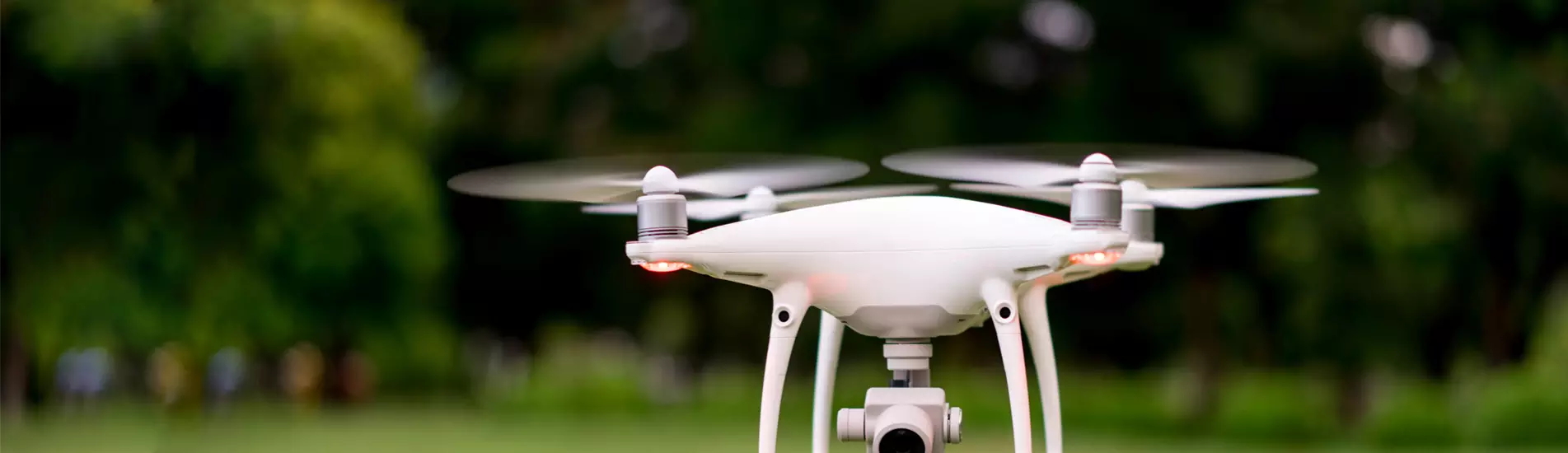
With the rapid development of UAV technology, the Mountain Search And Rescue Drones is gradually changing the face of mountain rescue, opening up new possibilities for rescue operations, and providing a variety of air and space integrated emergency search and rescue application solutions.     Pain Points in the Mountain Rescue Industry             Complex and Changeable Terrain: Mountain areas usually have a lot of ups and downs, including steep slopes, cliffs, ravines, etc. These complex terrains bring great challenges to the rescue work. These complex terrain brings great challenges to the rescue work.               Dense Vegetation Cover: mountain areas are often covered with dense vegetation, obstructing the field of vision, making it difficult for search and rescue personnel to find traces of trapped people with the naked eye. At the same time, walking in the dense vegetation will also consume more physical strength and time, reducing the efficiency of search and rescue.               Human Violations: some people in the mountain area for illegal hunting, medicine, mining and other activities, these behaviors not only destroy the natural environment, but also increase their own security risks.               Communication Difficulties: Mountain areas usually have poor signal coverage and unstable signals. Especially in remote mountains and canyons, this makes it difficult for trapped people to get in touch with the outside world, and also brings great obstacles to the communication of search and rescue personnel.               Limited Resources: mountain search and rescue requires a lot of human, material and financial resources, the cost is high. Due to the special terrain of mountainous areas, it is often difficult to deploy and supply resources.       Advantages of  Aerial Rescue Drones In Mountain Rescue               Mobility and Flexibility, Rapid Deployment: UAVs are not restricted by terrain and can easily fly over complex and difficult to pass areas, and can be quickly deployed to the rescue site in a short period of time.               
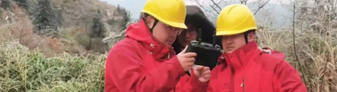
Comprehensive Field of View, Accurate Search and Rescue: the UAV has a high-altitude ultra-clear field of view, and is able to acquire ground information in a comprehensive and real-time manner. By carrying thermal imaging cameras and other equipment, the UAV can scout for ground heat sources, quickly investigate and locate the position of target personnel in the first time, and provide accurate target information for rescuers.               Multi-Functional Integration, Assisting Rescue: the UAV can integrate a variety of functional modules, providing a variety of means for rescue. Such as throwing module, shouting device, etc., timely supply of materials and emotional appeasement. In addition, it can also carry communication equipment to act as a temporary relay station, providing relay services for communication in extreme environments.               Information Synchronization, Air-ground Coordination: the UAV can synchronize the detected information to the ground command platform in real time, realizing air-ground coordinated operation. Thus, a more accurate and efficient rescue program can be formulated.     Application Scenarios   01. Wild Search and Rescue             The environment of wildland search and rescue is harsh, with large differences in terrain height, vegetation cover, obstructed vision, and not easy to find. Traditional field search and rescue personnel, often aimless carpet search, while the high altitude advantage of the drone, can quickly obtain comprehensive, real-time ground information, to achieve efficient search.               In the event of a lost person incident, the rescuer can then mark the spot on the map, further actualize the situation through the panorama, determine the specific location of the trapped person, and forward the location information of the trapped person to the rescue team, and implement the search and rescue at a rapid speed.         Maneuvering Search and Rescue:  the advantage of high altitude maneuvering of the UAV is not affected by the ground environment, and search and rescue can be launched quickly; Rapid Map Building: quickly generate 2.5D maps to create electronic command map; Clue Labeling and Research and Judgment: label existing information for research and judgment; Route Guidance: send the reference path of rescue guidance to the handheld terminal; Pointing and Positioning: through the laser pointing and positioning function, synchronize the coordinates of trapped people and the number of people with the rescue force;   Information Synchronization: real-time synchronization of the information detected by the flyer to the command platform.   
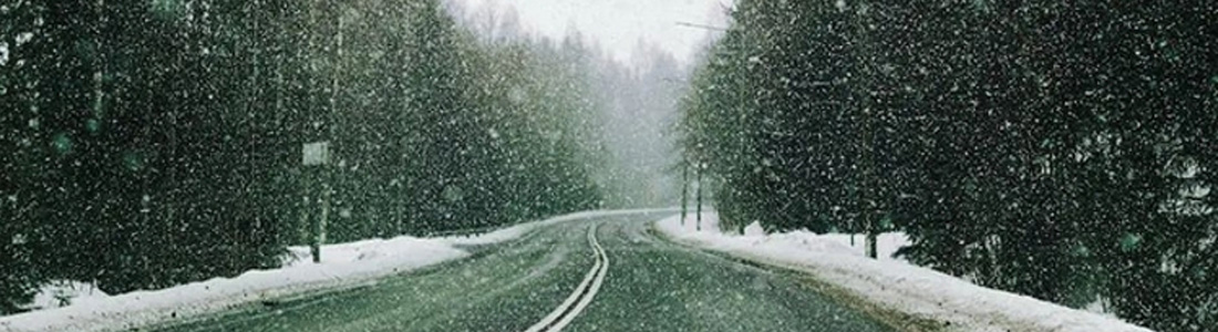
02. Night Search and Rescue             Poor visibility at night. In mountain search and rescue, the drone incarnates “clairvoyance”, equipped with thermal imaging camera can present different temperature points, in the night or poor line of sight, quickly find the human body heat source, the rescue team through the mountainous environment and the human body heat formed by the stark contrast to accurately locate the lost person. The visible light camera can provide clear images to further confirm the identity and status of trapped people.             03. Emergency Rescue             Reconnaissance drones have been formally included in the central emergency material stockpile varieties. In emergency rescue the drones can transmit the captured images, videos and other information collected in real time back to the ground control station or the rescue command center during the flight. Ground staff can view the information transmitted back from the drone in real time through the cloud platform, and analyze and process this information. Provide precise guidance for rescue operations. With the high-precision maps transmitted back from the drone, search and rescue personnel can perform their tasks more safely and efficiently. With the multi-channel drone low-latency high-definition images, all members can watch the live broadcast in real time and search for the rescue target together.       04. Auxiliary Rescue             If a trapped person is found, the UAV can communicate with the trapped person by carrying a shouting device to calm them down and allow them to save their strength. During the process of ground rescuers approaching the trapped person, the UAV can continue to monitor the situation in the air, providing real-time navigation and some simple self-rescue guidelines for the ground rescuers to help them avoid the dangerous area and choose the best rescue route.               In some special cases, such as the location of the trapped personnel is difficult to approach, the UAV can carry a throwing module to throw some small rescue materials to the trapped personnel, such as medicine, food, water and other protection materials, to provide them with the necessary support and help.                 
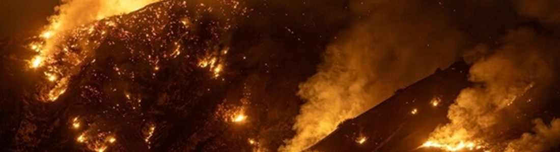
Science and technology assistance, the combination of resistance and defense. Drone technology has become an indispensable scientific and technological force in the field of emergency firefighting, providing powerful support for real-time investigation and search and rescue at complex scenes, giving front-line personnel wings and better guarding people's lives and property safety.
  • What are the do's and don'ts of drone use with rain and snow on the way?
    What are the do's and don'ts of drone use with rain and snow on the way?
    Nov 17, 2025
        1. Ensure sufficient power, and should not take off if the temperature is too low               Before performing the operation, for safety reasons, the drone pilot should ensure that the battery is fully charged when the drone takes off, so as to ensure that the battery is in a high-voltage state; if the temperature is low and the takeoff conditions are not met, the drone should not be forced to take off.   2. Preheat the battery to keep it active                         Low temperatures can cause the battery temperature to be too low for takeoff. Pilots can place the battery in a warmer environment, such as indoors or inside a car, before performing the mission, and then quickly remove the battery and install it when the mission requires it, and then take off to perform the mission. If the working environment is harsh, UAV pilots can use a battery preheater to preheat the UAV's battery to keep it active.     3. Ensure sufficient signal               Before taking off in snow and ice conditions, please make sure to check the battery power of the drone and the remote control, at the same time, you need to pay attention to the surrounding operating environment, and make sure that the communication is smooth before the pilot takes off the drone for operation, and always pay attention to the drone in the visual range of the flight, so as not to cause flight accidents.             4. Increase the alarm value percentage               In low temperature environment, the endurance time of the drone will be greatly shortened, which threatens the flight safety. Pilots can set the low battery alarm value higher in the flight control software, which can be set to about 30%-40%, and land in time when receiving the low battery alarm, which can effectively avoid over-discharging of the drone's battery.         5. Avoid the entry of frost, ice and snow               When landing, avoid the battery connector, drone battery socket connector or charger connector directly touching the snow and ice, so as to avoid short circuit caused by snow and water.           6. Pay attention to warmth protection               Pilots need to be equipped with enough warm clothing when operating in the field to ensure that their hands and feet are flexible and easy to fly, and when flying in icy or snow-covered weather, they can be equipped with goggles to prevent light reflection from causing damage to the pilot's eyes.      
  • Drones fill gaps in grid inspection
    Drones fill gaps in grid inspection
    Nov 19, 2025
                Ice-covered power grids can cause conductors, ground wires and towers to be subjected to abnormal tensions, resulting in mechanical damage such as twisting and collapsing. And because insulators covered with ice or melting process will cause the insulation coefficient to drop, easy to form flashover. 2008 winter, an ice, resulting in China's 13 southern provinces power system, part of the slice of the grid and the main network unlinked. Nationwide, 36,740 power lines were out of service due to the disaster, 2018 substations were out of service, and 8,381 towers of 110 kV and above power lines were down due to the disaster. As many as 170 counties (cities) were without power nationwide, and some areas were without power for more than 10 days. The disaster also caused some railroad traction substations to lose power, and the operation of electrified railroads such as Beijing-Guangzhou, Hukun and Yingxia was interrupted.               The ice disaster in January 2016, although the two networks have improved the level of preparedness for the disaster, still caused 2,615,000 users to be without power, counting 2 35kV lines tripped and 122 10KV lines tripped, bringing great impact on people's life and production.               Before this winter's cold wave, the State Grid Power Supply Company has made all kinds of preparations. Among them, part of the power grid in Mudanggang, Ya Juan Township, Shaoxing Shengzhou is located in the mountainous area, and the special geographic conditions and climatic characteristics make this area of the line often become the earliest risk point for ice overlay in the whole of Zhejiang. And this area at the same time is very prone to extreme weather such as ice-covered roads, rain and snow, making it difficult for manual inspections.             And at this critical moment, the Long Endurance Low Temperature Operation UAV took up the mountainous areas covered with ice inspection of the heavy responsibility. the early morning of December 16, the mountainous areas of the temperature has dropped to below zero degrees, the probability of ice disaster dramatically increased. Shaoxing power transmission operation and inspection center inspectors, in the snow and ice covered mountain road to the target line, the car anti-skid chain are broken a few. After inspectors assessed the difficulty and risk, the team planned to release the drone.               Shaoxing Transmission Operation and Inspection Center also experimented with a drone plus LIDAR for ice cover scanning. The drone carries the lidar pod, real-time generation of three-dimensional point cloud model, online calculation of arc and cross span distance. The collected curvature of the ice-covered arc pendant combined with the type of conductor and span parameters can quickly calculate the weight of the conductor ice-covered, to assess the degree of risk.             It is reported that this is the first time that China's power grid has used a drone to carry out long-duration ice-covering inspection. This innovative inspection method allows the grid operation and maintenance department to grasp the degree of ice-covering risk and accurately locate the risk points in the fastest time and in a safer way. The UAV's low-temperature adaptability, long flight time and wind resistance were well proven in this mission. It adds another effective means for power grid ice-covering inspection and fills the blank of ice disaster inspection under severe weather, and we believe that UAVs will be more widely popularized and applied in this field in the future.
  • An all-encompassing detection method for drone power inspections
    An all-encompassing detection method for drone power inspections
    Nov 20, 2025
                  Electric utilities had long been limited by the bottlenecks of the traditional inspection model, including difficult-to-scalable coverage, inefficiencies, and the complexity of compliance management.               Today, High Resolution Image Data Collection Drones is integrated into the power inspection process, which not only greatly broadens the boundaries of inspection, but also significantly improves operational efficiency and effectively ensures the compliance of the inspection process, completely subverting the plight of traditional inspection.               Through the use of billion-pixel cameras, combined with automated flights, specialized inspection software and efficient data analysis, end-users of drones have succeeded in increasing the productivity of drone inspections by multiples.               Productivity in the context of inspection: Inspection productivity the value of image acquisition, conversion, and analysis/the number of labor hours required to create these values.               With the right cameras, autoflight, and artificial intelligence (AI)-based analytics and software, it is possible to achieve scalable and efficient detection.   How do I accomplish that?             Optimize every step in the process by using an all-encompassing inspection method to increase productivity. This all-encompassing approach not only increases the value of the data collected, but also significantly reduces the time required for collection and analysis.   In addition, scalability is a key aspect of this approach. If testing lacks scalability, it is vulnerable to future challenges, leading to increased costs and reduced efficiency.               Scalability must be prioritized as early as possible when planning for the adoption of an all-encompassing drone inspection method. Key steps in optimization include the use of advanced image acquisition techniques and the use of high-end imaging cameras. The high-resolution images generated provide accurate visualization of the data.               In addition to finding defects, these images can train artificial intelligence models that help inspection software to detect defects, creating a valuable image-based dataset.
  • Drone maintenance tips(1/3)
    Drone maintenance tips(1/3)
    Nov 24, 2025
    During the use of drones, is it often neglected the maintenance work after use? A good maintenance habit can greatly extend the life of the drone.   Here, we divide the drone and maintenance into several segments. 1. Airframe maintenance2. Avionics system maintenance3. Spraying system maintenance4. Spreading system maintenance5. Battery maintenance6. Charger and other equipment maintenance7. Generator maintenance   In view of the large amount of content, the entire content will be released in three times. This is the first part, which contains the maintenance of airframe and avionics system.         Airframe Maintenance   (1) use a wet rag to wipe the outer surface of other modules such as the aircraft front and rear shell, main profile, arms, folding parts, stand and stand CNC parts, ESC, motor, propeller, etc. clean. (2) carefully check the fixing screws of the main profile, folding parts, CNC parts of the stand, etc. one by one, tighten the loose screws, and replace the screws immediately for the slippery ones. (3) check the motor, ESC and paddle fixing screws, tighten the loose screws and replace the slippery screws. (4) check the motor angle, use the angle meter to adjust the motor angle. (5) for the operation of more than 10,000 acres of aircraft, check whether there are cracks at the motor fixed arm, paddle clip, and whether the motor shaft is deformed. (6) paddle blade broken timely replacement, paddle clip gasket wear timely replacement.           Avionics System Maintenance (1) the residue and stain inside the harness connector of the main control, sub-board, radar, FPV, ESC and other modules using alcohol cotton to wipe clean, dry and then insert. (2) check whether the wire harness of the electric steam module is broken, pay attention to the RTK, remote control receiver harness must not be broken. (3) the battery copper interface of the sub-board using alcohol cotton to wipe one by one to remove copper rust and black firing traces, such as copper obviously burned melting or bifurcation, timely replacement; clean and dry after applying a thin layer of conductive paste. (4) check whether the sub-board, the main control screws are loose, tighten the loose screws, replace the slip wire screws. (5) check the battery bracket, bracket pulley, silicone gasket damage or missing need to be replaced in a timely manner.
  • Drone maintenance tips(2/3)
    Drone maintenance tips(2/3)
    Nov 25, 2025
    During the use of drones, is it often neglected the maintenance work after use? A good maintenance habit can greatly extend the life of the drone.   Here, we divide the drone and maintenance into several segments.1. Airframe maintenance2. Avionics system maintenance3. Spraying system maintenance4. Spreading system maintenance5. Battery maintenance6. Charger and other equipment maintenance7. Generator maintenance   In view of the large amount of content, the entire content will be released in three times. This is the second part, which contains the maintenance of the spraying and spreading system.       Sprinkler System Maintenance   (1) use a soft brush to clean the aircraft's medicine tank inlet screen, medicine tank outlet screen, nozzle screen, nozzle. (2) fill the medicine tank with soapy water, use the brush to scrub the pesticide residue inside the tank and external stains, and then pour out the sewage, noting that silicone gloves must be worn to prevent pesticide erosion. (3) then add full soapy water, open the remote control, power up the aircraft, use the remote control's one-touch spray button to spray out all the soapy water, so that the pump, flow meter, pipeline for thorough cleaning. (4) and then add water, use a key spray all out, repeat several times until the pipeline is thorough and the water is odorless. (5) for a relatively large amount of work, the use of more than a year of aircraft also need to check whether the water pipe is broken or loose, timely replacement.         Spreading System Maintenance   (1) turn on the spreader, flush the barrel with water and use a brush to scrub the inside of the barrel. (2) dry the spreader with a dry towel, remove the spreader, take off the discharge tube, and brush it clean. (3) clean the stains on the surface of the spreader, the wire harness terminals, the weight sensor and the infrared sensor with alcohol wool. (4) place the air inlet screen facing downward, clean it with a brush, then wipe it with a wet rag and dry it. (5) remove the motor roller, wipe the roller groove clean, and clean the dust and foreign matter of the inner and outer shafts of the motor with a brush, then apply an appropriate amount of lubricant to maintain lubrication and rust prevention.
  • Drone maintenance tips(3/3)
    Drone maintenance tips(3/3)
    Nov 26, 2025
    During the use of drones, is it often neglected the maintenance work after use? A good maintenance habit can greatly extend the life of the drone.    Here, we divide the drone and maintenance into several segments.   1. Airframe maintenance2. Avionics system maintenance3. Spraying system maintenance4. Spreading system maintenance5. Battery maintenance6. Charger and other equipment maintenance7. Generator maintenance   In view of the large amount of content, the entire content will be released in three times. This is the third part, including battery maintenance and storage, and other equipment maintenance.     Battery maintenance and storage   --Maintenance--   (1) the surface of the battery and the panel of the drug stains wipe clean with a wet rag. (2) check the battery for signs of bumping, if there is a serious bumping resulting in deformation or bumping need to check whether the cell is damaged by compression, such as cell damage leakage, bulging need to replace the battery in a timely manner, the old battery scrap treatment. (3) check the battery snap, if damaged timely replacement. (4) check whether the LED light is normal, whether the switch is normal, if abnormal timely contact the after-sales service processing. (5) use alcohol cotton wipe the battery socket, water washing is strictly prohibited, remove the copper rust and black lightning traces, copper pieces such as burning melting serious timely contact after-sales maintenance treatment.   --Storage--   (1) when storing the battery, pay attention to the battery's power cannot be lower than 40%, to keep the power between 40% and 60%. (2) long-term storage of batteries should be charged and discharged once a month. (3) when storing, try to use the original box for storage, avoid storing with pesticides, no flammable and explosive items around and above, avoid direct sunlight, keep dry and ventilated. (4) the battery must be stored on a more stable shelf or on the ground.         Charger and other equipment maintenance   --Charger--   (1) wipe the appearance of the charger, and check whether the charger's connecting wire is broken, if found broken must be repaired or replaced in a timely manner. (2) check whether the charging head is burned and melted or fire traces, use alcohol cotton to wipe clean, serious replacement. (3) then check whether the charger's heat sink is dusty, use a rag to clean up. (4) too much dust when removing the charger shell, use a hair dryer to blow away the dust above.   --Remote control & punter--   (1) use alcohol cotton to wipe the remote control and punter shell, screen and buttons clean. (2) toggle the remote lever, and likewise wipe the rocker slit clean with alcohol cotton. (3) use a small brush to clean the remote control's heat sink dust. (4) keep the remote control and punter power at about 60% for storage, and the general battery is recommended to be charged and discharged once in a month or so to keep the battery active. (5) remove the remote control rocker and put the remote control in a special box for storage, and put the punter in a special bag for storage.         Generator maintenance   (1) check the oil level every 3 months and add or replace the oil in a timely manner. (2) timely cleaning of the air filter, recommended every 2 to 3 months cleaning. (3) check spark plugs every six months, clear carbon, and replace spark plugs once a year. (4) calibrate and adjust the valve lash once a year, the operation needs to be operated by professionals. (5) if not used for a long time, the tank and carburetor oil should be put clean before storage.
  • Israel grants “world's first” drone flight license
    Israel grants “world's first” drone flight license
    Dec 02, 2025
    A Tel Aviv-based drone startup has received the world's first permit from Israel's Civil Aviation Authority (CAAI), authorizing drones to fly across the country via its unmanned autonomous software.     High Lander has developed the Vega Unmanned Traffic Management (UTM) platform, an autonomous air traffic management system for drones that approves and denies flight plans based on prioritization protocols, suggests changes to flight plans when needed, and provides relevant real-time notifications to operators.   Vega is used by EMS drones, robotic air safety, delivery networks and other services operating in shared or overlapping airspace.   The CAAI recently passed an emergency ruling stating that drones may only fly in Israel if they continuously broadcast operational data to an approved UTM system. The data broadcast by the drones can be shared with approved organizations, such as the army, police, intelligence services and other homeland security forces, upon request. A few days after the ruling was issued, High Lander became the first company to receive a license to operate as an "air traffic management unit". This is the first time that UTM connectivity has been a prerequisite for drone flight approval, and the first time that a UTM provider has been legally authorized to provide this service.   High Lander CTO and co-founder Ido Yahalomi said, "We are very proud to see Vega UTM begin to fulfill the purpose for which it was designed one to manage unmanned aviation on a national scale." The platform's robust monitoring, coordination and information sharing capabilities make it perfect for the first recipient of this license, and we are excited to see its capabilities recognized by state aviation regulators."。
1 2 3 4 5

leave a message

leave a message
If you are interested in our products and want to know more details,please leave a message here,we will reply you as soon as we can.
submit

Our hours

Mon 11/21 - Wed 11/23: 9 AM - 8 PM
Thu 11/24: closed - Happy Thanksgiving!
Fri 11/25: 8 AM - 10 PM
Sat 11/26 - Sun 11/27: 10 AM - 9 PM
(all hours are Eastern Time)

Contact Us: q157050@gmail.com

home

products

WhatsApp

Contact Us